
Pravin Kumar is a Senior Research Officer at the Bihar State Disaster Management Authority (BSDMA), Bihar.
Though there is a significant paradigm shift in disaster management, there are still some existing gaps in general practices and particularly in the context of earthquake risk management at the community level. This paper focuses on identifying the existing gaps and accordingly providing appropriate suggestions so we can be more prepared and develop our coping capacity and fill up the gaps especially at the community level. The paper also illustrates the idea behind the Seven Days Masons Hands-on Training on Earthquake Resilient Buildings at block headquarters in Bihar, one of the landmark activities towards a disaster-resilient Bihar.
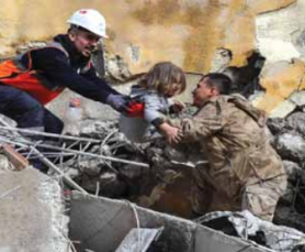
It is now globally understood that earthquakes do not kill; weak buildings do. The UNISDR Report, 2004 – Living with Risk indicates that:-
- Disasters are increasing each year
- People affected by disaster are rising
- Overall, disasters are becoming more deadly
- Overall, disasters are becoming more costly
- Poor countries assuming much greater proportions of disaster impacts
 Developing and underdeveloped countries are becoming more vulnerable (directly or indirectly) to disasters. Rapid urbanisation and its associated factors have drastically changed construction practices in urban areas and rural areas. In the Indian context, it can be understood with the help of a comparative analysis of census houses of 2001 and 2011 used as residence and residence-cum-other use. These census houses are classified as permanent, semi-permanent or temporary, based on the type of material used in the construction of walls and roofs. The graph indicates that permanent structures in India have increased, especially in rural areas vis-a-vis urban areas.
Bihar: A Hub of Disaster
 Disasters are not bound by geographical, political, social or economic boundaries. When they strike, they affect everyone, either directly or indirectly. Accordingly, Bihar, a land-locked State, shares boundaries with Nepal in the north, West Bengal in the south-east, Jharkhand in the south, and Uttar Pradesh in the west. The river Ganga which flows from west to east divides its plain into two unequal halves i.e. North Bihar (21 districts) and South Bihar (17 districts).
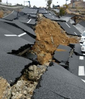
Due to the geo-climatic condition of Bihar, the large landmass is located in vulnerable areas along with the physical, social and economic vulnerability of the people. Such vulnerabilities compel people to live in high-risk areas. Such disaster risks emerge from the interplay of multiple contributing factors. Besides human-induced hazards, the State is highly prone to various natural hazards like floods, droughts, earthquakes, lightning, fire, heat and cold waves, etc. That is why Bihar is considered the hub of disasters. A unique paradox is witnessed in Bihar wherein flood and drought events occurred in the same year (2013) in the same district.
In the context of an earthquake, the Himalayan frontal thrust does not run in Bihar. It runs across the border in Nepal. Apart from the Himalayan faults, there are several other tectonic features within the landmass of Bihar, such as the East Patna Fault, West Patna Fault, Munger-Saharsa Ridge, Katihar-Nilphamari Fault and Malda-Kishanganj Fault that are capable of producing significant earthquakes. (Source: Amateur Seismic Centre, Pune, 2019).
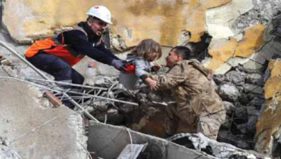
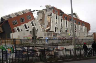
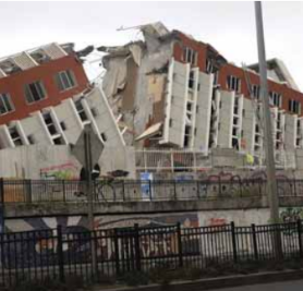
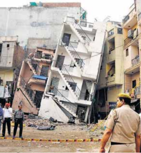
Out of 38 districts, 8 districts fall in Seismic Zone V, including Patna. 24 districts fall in Zone IV, and the rest of the 6 districts fall in Zone III. The State experience periodic tremors, particularly in the northern part. In the past two centuries, Bihar faced devastating earthquakes in 1833 and 1934, followed by less damaging earthquakes in 1988 and 2015. These earthquakes caused severe destruction and loss of lives, properties, economy and infrastructure etc., in the rural areas of Bihar.
 In August 2013, the Bihar State Disaster Management Authority (BSDMA), Govt. of Bihar, carried out a detailed analysis taking into consideration the possible damage scenario under a hypothetical event, having intensity similar to the 1934 earthquake. The probable loss of human lives and the probable number of housing that will need reconstruction or retrofitting was computed (Census 2011) for various districts and the blocks within the districts. Accordingly, the following grim picture of losses has emerged for the State.
- Loss of human lives may be to the extent of 2,22,337 if an earthquake occurs at night, but 72,766 if an earthquake occurs during daytime.
- About 20% of the total housing in Bihar will need re-construction
- About 45% of the total housing in Bihar will need repairing and retrofitting.
(Source: Damage scenario under hypothetical recurrence of 1934 earthquake intensities in various districts in Bihar, Dr. Anand S. Arya, Member, BSDMA)
 In March 2019, the Building Materials and Technology Promotion Council (BMPTC), Ministry of Housing and Urban Affairs, Govt. of India updated the Vulnerability Atlas of India (BMTPC, 2006) concerning the 2011 Census housing data. As per the updated atlas, an earthquake damage risk for Bihar is classified into three categories based on three seismic zones – V, IV and III.
According to the percentage of areas falling in different seismic zones in Bihar, the corresponding maximum intensity is as follows:
In January 2019, a study – Bimodal Seismicity in the Himalaya Controlled by Fault Friction and Geometry – was conducted by Luca Da Zilio and his team. The study indicates that the energy released from the depths of the earth in 2015 caused the Nepal-Bihar earthquake. Due to the release of energy, new and even greater stress areas have developed near the same location. It increases the possibility of earthquakes of magnitude 8 or more. Given the possibility of such a strong earthquake, it becomes even more important that new buildings should be earthquake-resistant and old ones should be strengthened at the earliest.
Infrastructure is one of the main indicators of development. Physical infrastructure drives economic growth, while social infrastructure impacts human resource development. That is why, in addition to Resilient Villages, Resilient Livelihoods, Resilient Basic Services, and Resilient Cities, the Roadmap for Disaster Risk Reduction (2015-2030), the Government of Bihar considers resilient infrastructures as one of the fifth components of a disaster-resilient Bihar.
 The concept of resilience refers to the capability to:
- Assess disaster and climate change-induced risks
- Address disasters through risk-informed development planning
- Anticipate and cope with shocks and stresses through risk reduction measures
- Preserve the ecosystem
- Recover from disaster(s) through building back better approach
- Develop capabilities and assets without creating disaster risks
- Efficacy and effective access to infrastructure
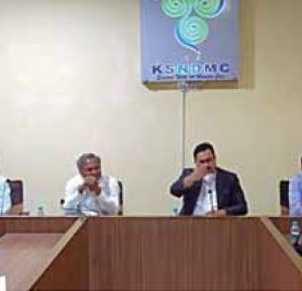
Thus, the basic sense of resilience in disaster and development context means – “Vikas aisa ho ho jo aafat se bachaye, Vikas aisa na ho jo aafat ban jaaye”. There are several disaster risk reduction (DRR) measures/actions needed towards resilience building within development, with the recognition that resilience is not a fixed-end state but a dynamic set of conditions and processes. Among the many, one of the most important measures towards a disaster-resilient Bihar is the Seven Days Masons Hands-on Training on Earthquake Resilient Buildings at block headquarters in the State. This one is a flagship programme of the Bihar  State Disaster Management Authority (BSDMA).
The keys features of the seven days masons training at the block level are:
- Wage Compensation: Since masons are daily wage workers, accordingly, the 30 experienced selected masons get a compensation of Rs. 4900/- (@Rs. 700 per day) after completing the training.
- Community Driven: Masons are selected from the local community. Emphasis is laid that masons should participate in almost all the Panchayats of the block. Block officials disseminate information among the community about the training programme.
- Training Module: A training module is one of the most important features of the training. Keeping the

Hands-on Activities educational background of the masons in mind, the module is prepared in pictorial form in simple Hindi language. Most of the words are taken from the local practising language.
- Activities: Training activities are divided into class activities based on PowerPoint Presentation (PPT), followed by hands-on activities. A team of trainers include two graduate civil engineers and a trained mason. Young trainers like these are dedicated to delivering their best. It has been observed that during the first one to two days, most of the masons hesitate to respond or connect themselves during classwork. Most of the masons have never experienced such PPT-based activities. The second day of training is very crucial because it is the day when some trainee masons drop out of the activities. After two days, it is

Trainers with Trained Masons noticed that the masons enjoy the training activities. They try to convince as well as discuss with each other regarding the tools and techniques of earthquake-resistant building construction.
- Social Status: After completing the seven days of training, the trained masons are recognised by the community as well as the administration. Their technical skills and self-worth are given a boost. They now understand that “earthquakes don’t kill, weak buildings do.”