
Dr. Bashir Ahmad is a senior lecturer in the Department of Education, Jammu & Kashmir (J&K), Er. Falak Zahoor works as teaching faculty at NIT Srinagar, J&K, Dr. S. Ahmad is a senior engineering geologist JKSPDC, Srinagar, J&K, Er. Basit Tariq works at National Highway & Infrastructural Development Corporation Ltd. J&K.
The unprecedented sinkhole formation on 11th February 2022 in the southwest of Kashmir Valley along the course of Bringi River caused a vertical shaft in the first instance. The ongoing process intended to elucidate the short-term climate variability, socio-ecological vulnerability inflicted upon southeast Kashmir Himalaya to better comprehend root causes and risk drivers co-determined by the dynamic relationship between the environment, rock type, and the water chemistry. The reported sinkhole caused an immediate first-order vertical shaft followed by the disappearance of runoff water from the stream. Predisposed litho logical and hydro geochemical environments play an important role in karstification. In view of the climate change scenario, similar events tend to occur repeatedly in the future and would pose a series of complex implications of likely nature at the local scale.
Geohazard scenario of Kashmir Valley
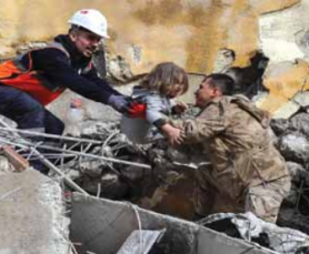
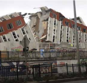
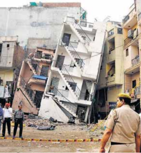
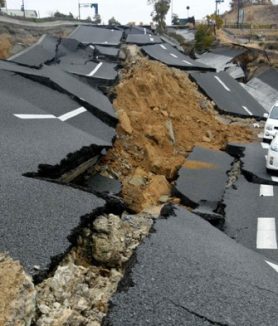
 Kashmir Himalaya a mid-latitude transverse valley in the north-west Himalaya is bounded by Zanskar and Pir Panjal orogeny in the north-northeast and south-southwest respectively with an average annual precipitation of about 84 cm. (Fig.1a). Owing to the significant orographic control, the climate of Kashmir Himalaya has a distinct seasonality with an average mean maximum and minimum temperature of 19.3°C and 7.3°C respectively while western disturbances mainly contribute to winter precipitation from November to April amounting to an average annual precipitation of about 84 cm. In general, the valley is spread over three major physiographic divisions i.e., mountains, Karewa uplands (Plio-Pleistocene deposits), and floodplain. A characteristic feature of the valley floor is the presence of axial river Jhelum which stretches over almost the entire length of the valley originating from Verinag spring in the south. The river Jhelum flowing in the northwest direction up to Wular Lake is fed by the waters of all small rivers draining the Kashmir Valley. In all, Kashmir Valley hosts 24 drainage catchments flowing across the enclosing transverse mountain ranges based on sixty sub-catchments supported by hundreds of micro-watersheds. Geological, Geomorphological, and hydro-metrological features make the Kashmir Valley genial for human habitation; however, often these factors make it equally vulnerable to various geohazards. More than 5.5 million people live in areas that are prone to multiple risks posed by various geo-hazards. In terms of impact, frequency, and economic loss, floods are the largest of all-natural hazards to which the Kashmir Valley is prone. Many disastrous floods with immense socio-economic and environmental impacts have occurred in the Kashmir Valley since 635 AD (Bhat et al., 2017). Equally, sporadic earthquakes have struck Kashmir Valley causing damage to the natural and built environment spanning 5000 years (Ahmad et al., 2009). Both the above-mentioned geohazards were often associated with landslides/snow avalanches in addition to their frequent metrological causes. Moreover, karstification, mass wasting, and neotectonic are the dominant active processes shaping the geomorphology of the valley. Apart from geo-hazards, Kashmir had witnessed innumerable biological hazards in the form of cholera epidemics during the course of its human history.
The Bringi River
River Bringi is one of the catchments of the Jhelum basin which lies towards the southeast of Kashmir Valley in NW Himalaya. It is formed by the confluence of two streams- the Razaparyin and the Anlan above the village of Wangom (Fig. 1b). The Razparyin stream [east Bringi] is the major one and flows due south up to its confluence with the Anlan [west Bringi] which flows from the southeast. After the confluence of these two mountain streams, river Bringi flows in a northwest direction up to its merger with the Arapat Kol in the west of Anantnag. The total length of the Bringi is about 61 kilometers along the Razparyin headstream. The valley floor of River Bringi drops to a minimum elevation of ~1588m [amsl] and eventually ascends to 4430m [amsl] at the headwaters with a surface area of 662 Km2. Following Koppen-Geiger climatic classification, Bringi catchment falls under the temperate climatic zone.
Bringi: The Carbonate Karst
Carbonate Karst is a terrain with distinctive hydrology and landforms arising from the combination of high rock solubility and well-developed secondary porosity. In most cases, carbonate karst is produced by chemical dissolution by slightly acidic water on a soluble layer of bedrock, probably limestone or dolomite, but karstification also occurs in evaporite rocks such as gypsum, anhydrite, and halite (Goldscheider et al., 2020). In the case of carbonate rocks, CO2 from the atmosphere and/or from the soil zone plays a key role in karstification (Ford and Williams 2007). Karstification is a self-amplifying and selective process; higher through-flow and chemical dissolution occurrence (Dreybrodt 1990). The intensity of karst processes can be expressed by the denudation rate i.e., millimeters of carbonate rock that are dissolved per thousand years. Field observations from all over the planet, complemented by theoretical and experimental work, have shown that the denudation rate depends on the climatic water balance, i.e., precipitation (P) minus actual evapotranspiration (ETa). Denudation rates often range between 10 and 100 mm/ kyr but can be close to zero under extremely dry conditions and exceed 200 mm/kyr under extremely humid conditions (Gabrovsek 2009). In view of climate change karstified carbonate rocks can also be encountered in Kashmir Basin where the present climatic conditions and hydrogeochemistry do favor intense karst development. Carbonate rocks occur unevenly in all catchments of the Kashmir basin and account for 1100 km2 of Kashmir Valley, of which 58% (638 km2) is occupied by the southern part of the valley (Shah et al., 2018) that have surface or near surface exposure. Bringi catchment is a terrain with an assemblage of rock types ranging in age from Paleozoics to Recent Deposits. Paleozoics include volcanic basalts, overlain by Mesozoic Limestone (Triassic) intermittently masked by glacio-fluvial Quaternary Deposits. These Carbonate rocks are present in all micro-climatic zones of the Valley and the type and degree of karst development are influenced by the dynamic relationship between intrinsic rock properties and hydrogeochemistry. Long-term dissolution, weathering, and bioconcentration of carbonate rocks result in the formation of lime soils. These soils at the bottom of the Bringi catchment may have different degrees of a mixture of carbonate rocks with high Ca, Mg content so that the soil is neutral or alkaline. The secondary enrichment of heavy elements during the carbonate rock weathering, dissolution residues from volcanic basalts, and surrounding rock formations result in soils with heavy metal element content. The Karst area in the southeast of Kashmir Valley suffers from a fragile geological environment and frequent landslides, avalanches, and flash floods which threaten habitat safety and social stability seriously. Nevertheless, Bringi Karst offers a variety of valuable natural resources such as freshwater from aquifers for human consumption, agricultural irrigation, and groundwater-dependent ecosystems.
11th February 2022 Sink-Hole in the Bringi River

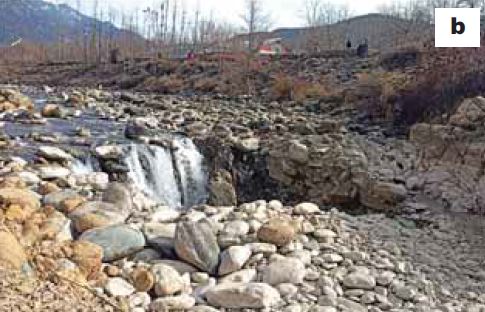
Infiltrating rainwater or meltwater containing CO2 from the atmosphere or soil zone enters the subsurface, circulates in the fissures and fractures of the carbonate rock, and results in karstification (although deep-seated sources of solutional aggressiveness can also be significant). Analogous to the above process, numerous sinks were identified along the banks of Bringi catchment along the bedding planes, rock joints larger open fractures, leading to accelerated growth of their apertures and eventually to the formation of hierarchically connected networks of solutionally widened fractures, conduits, and caves, which typically converge into a single master conduit drained by one large spring (Shah et al., 2018). Recently, a sinkhole developed in the bedrock of river Bringi at N33°57’8083” E75°33’8499” (Fig. 2). At the initial stage, a vertical shaft emerged in the middle of the river bed at Wndevalgam on 11th February 2022, and concurrently the flowing water found its way laterally through the coalescence of secondary fractures (Fig. 3b). Keeping in view the topographic expression of the lithology, subsurface geology and hydrogeochemistry of the southeast Kashmir Himalaya (Jeelani, 2008) is prone to such responses of climate variability. Reminiscent of the similar karst sink during the year 1995 is indicative of the ongoing karstification at a faster rate. Moreover, the recent sinkhole further increased in diameter on 26th February 2022. The recent sinkhole makes the stream disappear (Fig. 2) and disturbed the hydroecology downstream of the watershed (Fig. 3a).
Implications
 Karstification and consequent disappearance of the Bringi stream in the southeast of Kashmir Valley is an ongoing geohazard and pose a serious threat to the hydrological and ecological process of the karst springs beside the river is very sensitive to environmental disturbance: water temperature and dissolved oxygen along the spring-lake-river in forwarding flow; whereas in reverse flow the water level changes in the river may not be synchronized with the chemical changes, results in obvious chemical dissolution of the catchment in the upstream direction. In addition, the recent process may pose a series of severe environmental and geological problems in the karst areas, such as karst collapse, karst rocky desertification, degradation of karst landscape resources, shortage of karst water resources, karst critical zones, climate change, and other issues can impede the SDGS defined by UN 2030 Agenda.
Looking Back to See Forward
 Geological processes operating on the surface of earth sometimes bear historical evidence and are often preserved in the living memory. Such a repeating process within human history is referred to as “neotectonics”. In the year 1995, a similar sinkhole developed a few meters above in the same area which was later filled up with sand and gravel. The water of that disappeared stream was found in Achabal Spring. Hydrological processes operating on carbonate Stratigraphic is henceforth called “Karst Tectonics”, in accordance with established practice elsewhere. In the present context, it is suggested to fill back the sinkhole with river material so as to chock the vertical shaft and the lateral openings. These measures may restore the runoff of the affected river bed. Moreover, the tectonic factors that facilitate the drainage should be also taken into account- faults, joint sets that facilitate the drainage of superficial water flow by channels.
References:
Ahmad. B et al. (2009) ‘Historical record of earthquakes in the Kashmir Valley’, Himalayan Geology 30 (1), pp. 75-84.
Bhat. M. S. et al. (2018) ‘Flood hazard assessment of the Kashmir Valley using historical hydrology’, Journal of Flood Risk Management, pp. 1-13.
Dreybrodt W. (1990) ‘The role of dissolution kinetics in the development of karstification in limestone: a model simulation of karst evolution’, Journal of Geology, (98), 639–655.
Gabrovsek, F. (2009) ‘On concepts and methods for the estimation of dissolutional denudation rates in karst areas’, Geomorphology 106 (1–2) pp. 9–14.
Goldscheider, N. et al. (2020) ‘Global distribution of carbonate rocks and karst water resources’, Hydrogeology Journal. (28), pp. 1661–1677.
Jeelani, G. (2008) Aquifer response to regional climate variability in a part of Kashmir Himalayas in India; Hydrogeology Journal. 16 1625–1633.
Shah et al., (2018) Karst Geomorphology, Cave development, and Hydrogeology in the Kashmir Valley, Western Himalaya, India’, Acta Carsologica 47(1), pp. 5-21.