
Dr. Somnath Bera is an Assistant Professor at the Department of Geography, Central University of South Bihar, Gaya. He also served at IIT Delhi and holds M.Phil. and Ph.D. degrees from TISS, Mumbai.
The article discusses the present trend and future direction of landslide mapping based on GIS and Remote Sensing and also covers landslide mapping.
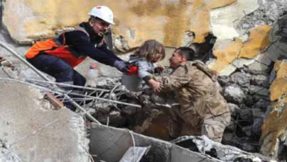
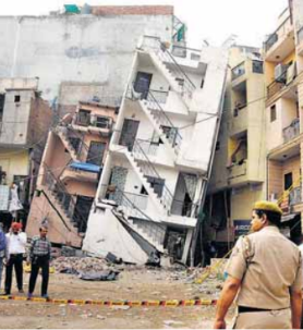
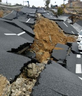
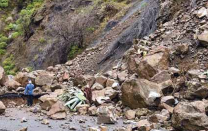
A landslide is the downslope movement of slope materials like rocks, debris, and soil under the force of gravity. It occurs in different forms, such as creeping, fall, slide, flow, etc. Generally, the nature of bedrock, slope angle, heavy rainfall, and earthquake are common causes of landslides. It is concentrated discreetly and locally, but it impacts mountainous communities frequently. According to the Centre for Research on the Epidemiology of Disasters, landslide causes the loss of 4914 people between 2014 and 2018 throughout the world. Apart from this figure, damage to houses, roads, and agricultural lands by landslides is a usual phenomenon in the mountainous region. Therefore, reducing the risk of landslides is essential for building a resilient society. GIS (Geographical Information System) and Remote Sensing play a significant role in risk reduction by identifying, monitoring, and predicting landslides.
Landslide mapping
The technique of landslide mapping is known as landslide inventory. It includes information about landslides, such as location, time, type, size, age, depth, impact, etc. A landslide inventory map helps to understand the frequency of landslide in an area and provide reliable information to construct a landslide impact assessment. There are various methodologies to generate landslide inventory maps, such as archive studies, field surveys, visual interpretation of satellite images, and automated detection. Archive studies include landslide information collection from the newspaper and records. The method helps collect historical landslide information. However, this method makes demarcating landslides difficult, especially when the data does not contain location information. The GPS (Global Positioning System) based field survey method is the potential to collect detailed data on landslides. However, a field survey is time-consuming, and it is very difficult to conduct in inaccessible – remote areas. To overcome the problem, numerous optical satellite images, aerial photographs, and google earth images use for mapping landslide inventory. The advantage of this method is that it can generate landslide maps for inaccessible areas. It can also prepare landslide maps for multiple periods. However, identifying landslides under forest cover is very difficult using this method. The landslide can be identified in specific cases by shaded relief images produced from LiDAR. In recent years, earth observatory (EO) satellite images have been widely used for the automated detection of landslides. The automated detection method is helpful for rapidly mapping a large area and emergency operations. The advantage of the automated detection method is that it does not depend on manual digitization for individual landslides. It can identify landslides automatically based on input satellite images. The limitation of the automated detection method is that it often treats numerous landslides as a single landslide. The detailed properties of landslides, such as depth, material, type, and failure style, are difficult to depict using this method.
Mapping of landslide-prone areas
The mapping of landslide-prone areas is known as landslide susceptibility mapping. It shows the future landslide occurrence zones of a region in a relative way. A highly susceptible zone indicates the areas that are more sensitive to landslides, whereas a less susceptible zone indicates a less sensitive area to landslides. There are numerous approaches to demarcate landslide susceptibilities such as the physical-based method, knowledge-based method, statistical method, and participatory-based method. In the physical-based method, the stability of the sites is measured using detailed soil, rock, and topographical data. It can measure stability numerically but is time-consuming and less feasible to conduct in a large area. On the other hand, the knowledge-based method and statistical method are more suitable for a larger area than a small area. In the knowledge-based methods, multiple maps of geo-environmental factors such as slope, aspect, curvature, drainage, lithology, and soil are prepared using GIS. Next, the weight of each factor is assigned and the susceptibility index value is determined by adding all weightings. The knowledge-based method is applicable where past landslides are inadequate and need an expert’s evaluation in the susceptibility mapping. However, the method can contain subjective biases as the expert determines weight. On the other, statistical-based methods determine the weight of geo-environmental factors based on their relation to past landslides. In the present decades, numerous machine learning algorithms such as decision tree, random forest, support vector machine, artificial neural network, and deep learning has been applied for susceptibility mapping. The statistical approach has the advantage as it determines susceptibility objectively. But, it cannot apply when past landslide data is limited. Apart from the above methods, the landslide-prone area is demarcated using local people’s perceptions and GIS. The method is user-friendly and suitable for generating awareness among people. However, the method emphasizes people’s perceptions rather than scientific principles.
We observe that all the above methods of landslide mapping have pros and cons. Therefore, integrating multiple methods is recommendable to build a complete landslide inventory. We also recommend developing web GIS for collecting landslide information from the local people. It is because small landslides often impact inversely on the community and these are difficult to capture even using high-resolution satellite images. In the practice of landslide susceptibility mapping, we can find the trend of machine learning applications is increasing. Overall the studies treat landslide susceptibility as static. However, the landslide is usually dynamic due to changes in triggering factors such as rainfall, earthquake, and slope cutting. Therefore, the study recommends applying the agent-based model for developing landslide susceptibility to depict the dynamic scenario in the future.